AREAS OF RESEARCH & INTEREST
Ecohydrogeology
|
The current approach and designs to watershed management & development has a very anthropocentric approach, with focus mostly on supply intervention and no regard to soil-plant-atmosphere hydrological flows. This has serious implications on the ecohydrological functions of a ecosystem. Current research focuses on integrating scientific approaches of ecology and hydrogeology in the study of groundwater-related ecosystems, habitats, organisms, vegetation, and sociocultural processes. The aim is to advance a better understanding, stewardship and policy around water use and its management.
|
|


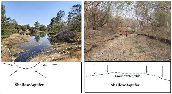
Stream and Groundwater interaction
|
Human induced changes to stream morphology, Land Use & Land Cover (LULC) and a disconnect with our natural groundwater resources (excessive and unplanned mining of groundwater aquifers) has reduced streamflow regimes and created regional groundwater drawdown, but attributing changes to streamflow and groundwater flow and its interaction to mere human activities is difficult. The changes in stream and groundwater interactions are also superimposed with weather-driven variability in precipitation, climatic variations, water use by riparian vegetation and long lags between pumping and hydrologic change. Systematic and long term monitoring of common pool resource is critical in understanding stream and aquifer interactions.
|
|
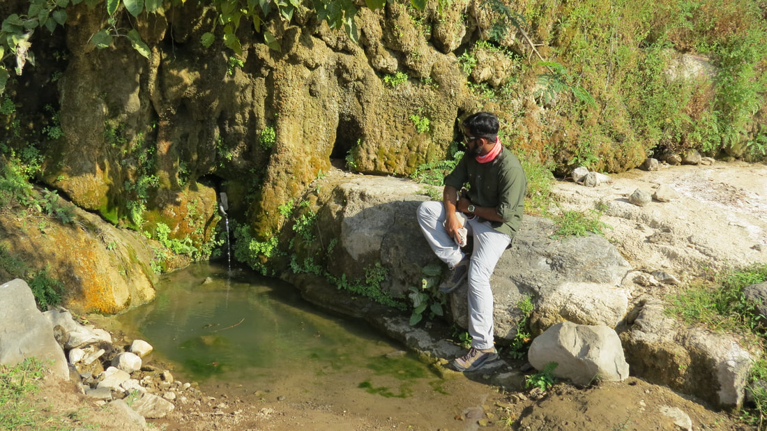
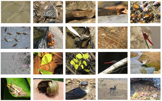
Groundwater Dependent Ecosystems (GDE's)
|
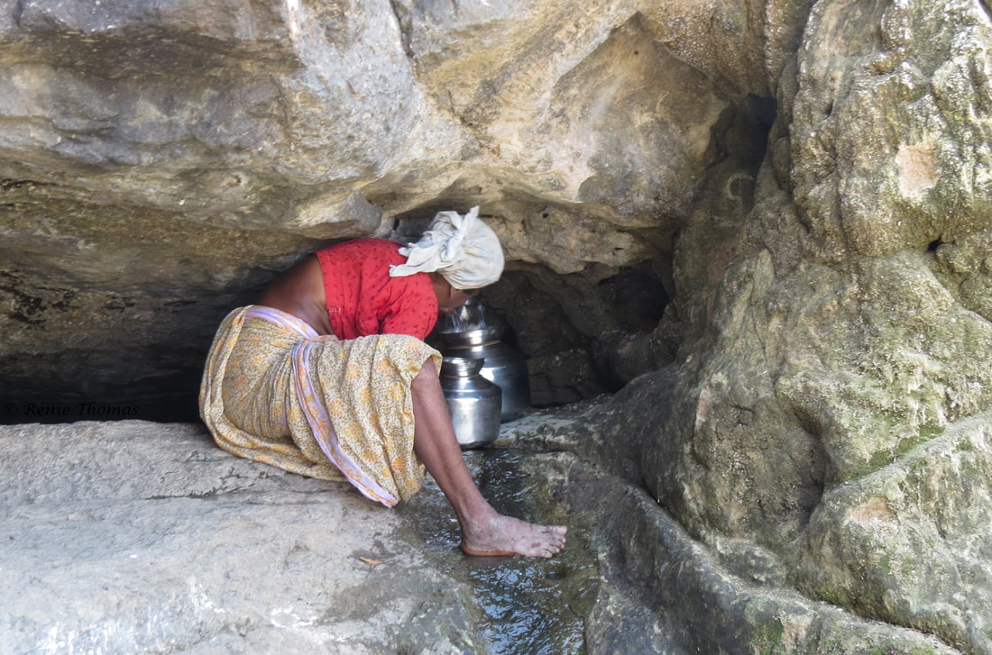
Groundwater Dependent Ecosystems (GDE's) are completely reliant on groundwater discharge, and include valuable ecosystems such as springs, wetlands, rivers, lakes and lagoons. They are an important feeders of freshwater source for intermittent and ephemeral streams in the mountain ranges. They host unique freshwater organisms, rich in biological diversity, source of drinking water for many tribal communities, important locations for native deep rooted medicinal plant communities (phreatophytes), and centers of religious ritual and practice. Currently, GDE's are poorly understood and are threatened by groundwater pumping, different land use activities and climate change impacting groundwater quality and quality.
|
|
Isotope Hydrology
|
Stable isotope hydrology can provide useful insights on the spatial & temporal changes in recharge rates, residence time of water in different aquifer systems and flow time through native vegetation. It can aid in mapping aquifers, assessing sources of water pollution, conserving water supplies, provide insights on various biogeochemical processes and eco-hydrological pathways to inform water-use policy. Currently, the focus is mainly to understand the ecological value of aquifers in different ecosystem types (semi-arid and forested ecosystem).
|
|


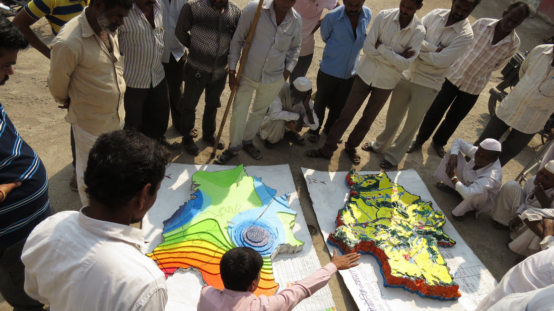
Geo-Cognition & Stakeholder Engagement
|
There are different perceptions and understanding among various water stakeholders around common pool resources, especially about groundwater and the aquifers that hold & transmit them. The aim of Geo-Cognition is to study how people perceive, understand and make decisions about aquifers, land-use linked to groundwater use, and various groundwater processes. Through various participatory tool, games and stakeholder engagement like Participatory 3D Model (P3DM), augmented reality sand box, groundwater games and water sessions with water stakeholders, the aim is to capture various perceptions governing the use and management of the invisible groundwater resource.
|
|


Socio-Hydrogeology
|
In order to address water scarcity and achieve human well being, a systems thinking approach & understanding of the dynamic interactions and feedbacks between people and water is critical. The aim is to unravel the dynamic cross-scale interactions and feedbacks between natural and human processes to address water challenges. It intends to bridge the gaps that exists between science and socially relevant water issues that affect, especially the most vulnerable communities - ecosystem people and ecosystem refugees. The approach aims to integrating interdisciplinary and transdisciplinary perspectives to build an inclusive and collective rationality to govern groundwater.
|
|


Investigating preferential pathways in Basaltic aquifers (Basaltic lava flow architecture & groundwater flow)
|
Understanding groundwater flows and stocks in basaltic rock aquifers (otherwise impervious) is critical for communities that are dependent on them for their drinking and agricultural use. The inherent differences in the basaltic lava flow morphologies, flow architecture, their geometry (jointing pattern), and the superimposing tectonic fabric (fracture zones and dyke swarms) provide complex preferential pathways for fluid movement and connectivity in multi-layered fractured-rock aquifers of the Deccan Volcanic Province (DVP). It provides interesting insights in better characterising groundwater flows, which includes contaminant transport, biogeochemical processes, and its future management.
|
|


© 2024 Renie Thomas. All Rights Reserved.
